Sunday 13th November  Ref: 2016/36

A well-planned and successful trip down the River Yare, passing the Reedham Swing Bridge and across Breydon Water and then, lowering everything, under The Bure Bridges and up the River Bure and under Acle Bridge after which we could re-assemble Lady Martina for the cruise home to Ropes Hill Dyke, Horning

This was a cruise organised at short notice. I saw how the weather had improved today and realised that we were experiencing Spring Tides and that low water would be very low today. The meant that we could pass under the Bure Bridges well before Low Water in Great Yarmouth, which was in the afternoon, and so could stem the tide for safely navigating under the bridges early on the tide. The remainder of daylight hours would also allow our passage up to Horning and so the decision was made. 

I dressed quickly and set off with Max, walking him along the Crabbett’s Marsh wood chippings road and then feeding him and loading him, and his accessories, into the old Range Rover. Then to gather my things together, opting against washing, shaving or anything else, so that I was very soon ready to go. Kathleen had been putting together foodstuffs and other essentials for our day out with the additional security of our meal for this evening should we have got delayed and stuck.

Once loaded, I rushed us to Brundall and there put Kathleen aboard as I unloaded the car and transferred Max, his kennel and all of our things onto Lady Martina. After disconnecting the shore-power, I successfully started the engines, unmoored and we set off, Visibility through the misted-up bridge windscreens was a challenge but I was soon on the main river and heading downstream at a good pace; the ebb flow behind us. This strengthened the further down the Yare we got and we were lucky that Reedham Swing Bridge was open such that our progress was uninterrupted and aided by a tide of up to 2kn at times.

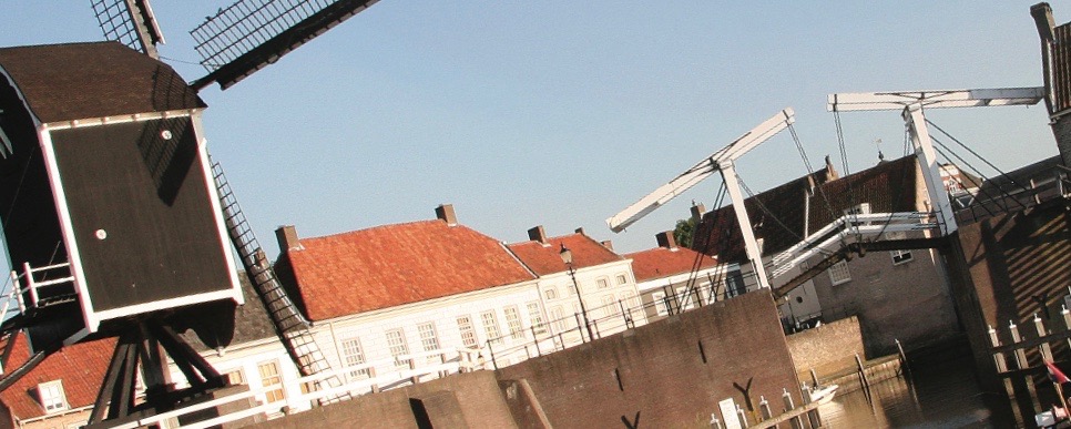
As we cruised across Breydon Water I used the space and time to engage the auto-pilot as Kathleen and I removed all of the canopy sections, the winch and the ensign flag staff and then lowered the mast and, after this, the side and forward windscreens such that we were right ready to approach the Bure Bridges. We had about 9ins to spare, even an hour-and-a-half before the 14.45 low water as the tide was due to sink to only .5m above LAT  today. This left us cruising against the strong tide up the lower Bure as we punched the flood tide.

I sat up on the bridge with no windscreens or covers for around two hours until we had negotiated Acle Bridge after which we could tie up briefly and then put up the windscreens and the mast to provide some shelter. We cruised on like that as the sun was setting but we just manage to arrive at Horning before dark and could then unload and put Lady Martina to bed. Instead of putting our new covers back on, Kathleen fetched the older ones from the loft and we fitted those instead for the winter, carefully laying out our best ones in the garage to dry prior to cleaning, treatement and safe storage until the Spring. 

14.6-15.2-11.2degC, 73-59-74%RH, 1024-1026mb rising, good viz, calm, sunny spells but cold with a F2 4-12kn  NNWly slight breeze

Cruise Data

Cruise Data

Distance: 32 nm

Total to date: 680 nm

Avg Speed: 5.8 kn

Duration: 5:20 hrs

Diesel: 72 ltrs approx (62 + 10 for heater)

Mooring:   free

Electricity: free

Water: free

WiFi: good and free

Charts

Broads map

Tides (UTC) (Springs)

Dover: HW 09:29 6.9, 21:55 6.9 &  LW 04:31 1.1 & 17.00 0.9

Lowestoft: HW 07:39 2.6 & 20:27 2.6 LW 01:39 0.9 & 14.12 0.5

Gorleston:  LW 01:09 13:42 

Great Yarmouth LW 02:09 & 14:42

Bridges - opening

 Reedham VHF 12

VHF channels

VHF 12

Cruise Data

Distance: 42 nm

Total to date: 42 nm

Avg Speed: 7 kn

Duration: 6:15 hrs

Diesel: 32 ltrs

Mooring: Free

Electricity: Free

Water: Free

Charts

Norfolk Broads

Bridges - Fixed

Acle 11ft

Bure Bridges 10ft 3in

Breydon Bridge 13ft

Bridges - opening

Reedham Swing ch12

Tides (UTC)

Tuesday 23rd May: Lowestoft HW 07:25 2.4, 19:17 2.4; LW 00:56 0.6, & 13:16 0.9 Gorleston HW 06:50 2.4, 18:42 2.4: LW 00:26 0.6 & 12:46 0.9  Yacht Station LW 13:46 UTC & 14:46 LT)

Cruise Data

Distance: 32 nm

Total to date: 74 nm

Avg Speed: 6.1 kn

Duration: 5:30 hrs

Diesel: 64 ltrs

Mooring: £17.50 Oulton Broad, £29.44 Lowestoft Haven, £59.10 (2 nights) Southwold

Electricity: Free at Oulton Broad and Lowestoft Haven, £4.30/night at Southwold (incl. in above)

Water: Free

VHF

Yarmouth and Southwold Ch 12

Oulton and Mutford Ch 73

Lowestoft Ch14

Charts

Norfolk Broads, 1543, 1535

Waypoints

106, 095, 094, 093, 102, 101

Locks 

Mutford Lock ch73 £13 for transit

Bridges - Opening

Oulton Road Lift ch73

Oulton Rail Swing ch73 


Tides (UTC)

Tuesday 23rd May: Lowestoft HW 09:32 2.6, 21:47 2.4; LW 03:26 0.4, & 15:49 0.5 Southwold HW 10:37 2.6, 22:52 2.6: LW 04:21 0.3 & 16:44 0.4

Cruise Data

Distance: 34 nm

Total to date: 108 nm

Avg Speed: 8kn

Duration: 4:15 hrs

Diesel: 64 ltrs

Mooring: £59.10 (2 nights) Southwold

Electricity: £4.30/night at Southwold (incl. in above)

Water: Free

VHF

Southwold Ch 12

Deben Ch 08

Woodbridge Tide Mill Marina Ch80

Charts

Norfolk Broads, 1543, 5607.5, 5607.8, Deben Chartlet

Waypoints

101, 102, 001, 092, 395, 168, 396, 397, 398

Locks and Bridges

none

Tides (UTC)

Sunday 28th May: Lowestoft HW 11:00 2.6, 23:31 2.6; LW 04:59 0.5, & 17:26 0.4 Southwold HW 12:05 2.6: LW 04:04 0.5 & 16:31 0.4: Walton-on-Naze HW 00:57 4.7, 13:27 4.4; LW 07:06 0.4, & 19:38 0.3 Deben Entr. HW 00:57 4.2 13:30 3.9: LW 06:46 0.4 & 19:18 0.3; Woodbridge Tide Mill HW 02:00

Cruise Data

Distance: 26 nm

Total to date: 134 nm

Avg Speed: 8kn

Duration: 3:30 hrs

Diesel: 54 ltrs

Mooring: £107.52 (3 nights) Woodbridge, £92.11 (3 nights) Ipswich Haven

Electricity: £3/night extra at Woodbridge (included in Ipswich)

Water: Free

VHF

Woodbridge Ch 80, Deben Ch 6,

Harwich Ch 71, Ipswich Lock Ch 68

Woodbridge Tide Mill Marina Ch80

Charts

 Deben Chartlet,  5607.6, 5607.7 (B & C)

Waypoints

398-396, 168, 395, 445, 126-129, 134-144 

Locks and Bridges

Ipswich 24hr Ch 68, freeflow at HT

Tides (UTC)

Wednesday 31st May: Walton-on-Naze HW 03:28 4.2, 15:58 4.0; LW 09:31 0.8, & 22:14 0.4 Deben Entr. HW 03:25 3.7 15:55 3.5: LW 09:11 0.8 & 21:54 0.4; Woodbridge Tide Mill HW 16:28; (17:28 BST); Ipswich HT 16:18 (17:18 BST)

Cruise Data

Distance: 59 nm

Total to date: 193 nm

Avg Speed: 9.1kn

Duration: 6:30 hrs

Diesel: 210 ltrs

Mooring: £92.11 Ipswich Haven (3 nights)

Electricity: (included in Ipswich)

Water: Free

VHF

Ipswich Lock Ch 68

Harwich Ch 71, 

Ramsgate Ch 14

Marina Ch 80

Charts

 55607.7, 5607.6, 5607.4, 5607.2, 5607.1, 5605.9

Waypoints

144>134, 129>127, 108, 103, 51, 49, 50, 76

Locks and Bridges

Ipswich Lock Ch68, freeflow HW+-1hr,

Ramsgate Inner Harbour Ch 14, HW+-2hr

Tides (UTC)

Saturday 3rd June: Walton-on-Naze HW 06:40 3.8, 19:08 3.7; LW 12:46 1.2,   Ipswich HW 07:05 3.8, 19:33 3.7; LW 12:46 1.1, Dover HW 06:09 5.5, 18:30 5.7; LW 13:18 1.9, Ramsgate HW 06:39 4.2, 19:00 4.5; LW 13:28 1.2, Ramsgate Inner Harbour (HW +-2) 18:00 to 22:00 LT

Cruise Data

Distance: 82 nm

Total to date: 275 nm

Avg Speed: 9.7kn

Duration: 8:30 hrs

Diesel: 280 ltrs

Mooring: £39 Ramsgate Marina (1 night)

£39 Brighton Marina (1 night)

Electricity: (included in both)

Water: Free in both

WiFi: Poor in Ramsgate; free and good at Brighton

VHF

Ramsgate Port Control and Dock Office Ch 14

Ramsgate and Brighton Marinas Ch 80

Off Dover Ch 74, 

Off Eastbourne 17

Charts

 5605 (B), 5605.9, 5605.5, 5605.13(C), 5604.4(A)

Waypoints

76, 50, 52>54, 74>75

Locks and Bridges

Ramsgate Inner Harbour Ch 14, HW+-2hr

Tides (UTC)

Tuesday 13th June: Ramsgate Inner Harbour (HW +-2) 18:00 to 22:00 LT; Ramsgate HW 01:21 4.8, 13:38 4.9; LW 08:18 0.8 20:38 0.8, Dover HW 00:51 6.2, 13:08 6.3; LW 08:08 1.3, 20:28 1.3; Shoreham HW 00:57 5.8, 13:21 5.8; LW 07:19 1.0, 19:36 1.2; Brighton HW 00:55 6.0, 13:19 6.0; LW 07:19 1.1, 13:36 1.3

Cruise Data

Distance: 42 nm

Total to date: 317 nm

Avg Speed: 9.3n

Duration: 4:30 hrs

Diesel: 146 ltrs

Mooring: £39 Brighton Marina (1 night); £97.28 Gun Wharf Quays (2 nights)

Electricity: (included in both)

Water: Free in both

WiFi:  free and good at Brighton and Portsmouth

VHF

Gunwharf Quays and Brighton Marinas Ch 80

At sea Ch 16 and ship-to-ship Ch 06, 

Portsmouth 11

Charts

 5605.4, 5605.3, 5600.17, 5600.13, 5600.12

Waypoints

75, 58, 60>63, 163>164

Locks and Bridges

none

Tides (UTC)

Wednesday 14th June: Brighton HW 01:28 5.9, 13:54 5.9; LW 07:52 1.2, 20:11 1.4  Shoreham HW 01:30 5.7, 13:56 5.7; LW 07:52 1.1, 20:11 1.3; Dover HW 01:19 6.1, 13:39 6.2; LW 08:43 1.4, 21:05 1.4;  Portsmouth HW 01:54 4.4, 14:31 4.4; LW 07:11 1.2 19:32 1.4, Southampton HW 00:58 4.2, 13:52 4.3; LW 06:59 1.1 19:20 1.3

Cruise Data

Distance: 38 nm

Total to date: 355 nm

Avg Speed: 7.6n

Duration: 2:30 hrs

Diesel: 38 ltrs

Mooring: £97.28 Gun Wharf Quays (2 nights); £51.20 Lymington Haven Marina (1 night)

Electricity: (included in both)

Water: Free in both

WiFi:  free and good at both

VHF

Gunwharf Quays and Lymington Haven Marinas Ch 80

Off Southampton 12

Off Cowes 69

Charts

 5600.12, 5600.13, 5600.9, 5600.7

Waypoints

164, 163, 064, 166, 068, 069

Locks and Bridges

none

Tides (UTC)

Friday 16th June:  Portsmouth HW 03:19 4.1, 16:04 4.2; LW 08:37 1.3 21:06 1.6, Lymington HW 02:55 2.8, 13:39 2.8; LW 08:14 1.1 20:49 1.3

Cruise Data

Distance: 70 nm

Total to date: 425 nm

Avg Speed: 7.6n

Duration: 9:15 hrs

Diesel: 130 ltrs

Mooring: £51.20 Lymington Haven Marina (1 night); €33.69 (£29.54/ night for two nights)

Electricity: (included in both)

Water: Free in both

WiFi:  free  at both, and good at Portsmouth, slow at Cherbourg

VHF

Lymington Haven Marina Ch 80

Channel Ch 16 (and Ch 67 Solent traffic)

Cherbourg 12, Marina Ch 09

Charts

 5600.7, 5600.5, 5600.9, 2110.01, 2110.10 and 2110.11(k)

Waypoints

069, 072, 220

Locks and Bridges

none

Tides (UTC)

Saturay 17th June:  Dover HW 03:36 5.7, 16:10 5.8; LW 10:51 1.8 , 23:30 1.6 Lymington HW 14:20 2.8, 17:06 3,0; LW 09:32 1.0 22:09 1.3 Portsmouth HW 04:15 4.0, 17:01 4.2; LW 09:32 1.4 22:09 1.7, Cherbourg HW 01:23 5.4, 13:58 5.2; LW 08:17 2.2 20:50 2.5

Cruise Data

Distance: 16 nm

Total Year to date: 469 nm

Avg Speed: 8 kn

Duration: 2:00 hrs

Diesel: 22 ltrs

Mooring: St Vaast  €90.20 (££39.56/night for two nights), Grandcamp  €36.40 (£31.92/night)

Electricity: (included in both)

Water: Free in both

WiFi:  free but poor at both

VHF

St Vaast Ch 09

Underway Ch 16/09

Grandcamp Ch 09

Charts

2110.11(C), 2110.10, and 2110.11(h)

Waypoints

229>228, 250>252

Locks and Bridges

St Vaast HW -2 1/4 to +3 1/2 16:18 to 21:33 French Time

Grandcamp Maisy HW -2 1/5 to +2 1/2 18:10 to 22:10 French Time

Tides (UTC)

Wednesday 21st June:  Dover HW 08:30 4.5, 21:00 4.6; LW 01:37 1.2, 14:02 1.1 Cherbourg HW 04:53 5.7, 17:27 5.9; LW 11:43 1.7 St Vaast HW 05:55 6.0, 18:27 6.2; LW 12:58 1.6, Grandcamp HW 06:06 6.4, 18:40 6.6; LW 13:01 1.8

Cruise Data

Distance: 16 nm

Total Year to date: 475 nm

Avg Speed: 8 kn

Duration: 2:00 hrs

Diesel: 22 ltrs

Mooring: St Vaast  €90.20 (££39.56/night for two nights), Grandcamp  €36.40 (£31.92/night)

Electricity: (included in both)

Water: Free in both

WiFi:  free but poor at both

VHF

St Vaast Ch 09

Underway Ch 16/09

Grandcamp Ch 09

Charts

2110.11(C), 2110.10, and 2110.11(h)

Waypoints

229>228, 250>252

Locks and Bridges

St Vaast HW -2 1/4 to +3 1/2 16:18 to 21:33 French Time

Grandcamp Maisy HW -2 1/5 to +2 1/2 18:10 to 22:10 French Time

Tides (UTC)

Wednesday 21st June:  Dover HW 08:30 4.5, 21:00 4.6; LW 01:37 1.2, 14:02 1.1 Cherbourg HW 04:53 5.7, 17:27 5.9; LW 11:43 1.7 St Vaast HW 05:55 6.0, 18:27 6.2; LW 12:58 1.6, Grandcamp HW 06:06 6.4, 18:40 6.6; LW 13:01 1.8

Cruise Data

Distance: 28 nm

Total to date: 453 nm

Avg Speed: 8.6n

Duration: 3:15 hrs

Diesel: 50 ltrs

Mooring: Cherbourg €33.69 (£29.54/ night for two nights); St Vaast €90.20/ 2 nights or £39.56/night

Electricity: (included in both)

Water: Free in both

WiFi:  free and slow at Cherbourg, unusable at St Vaast

VHF

Marinas Ch 9 at both 

Cherbourg Ch 12,

Underway 16/9

Charts

2110.11(k), 2110.10, 2110.11(c)

Waypoints

221>224, 226>229

Locks and Bridges

Gate at St Vaast HW-2:15 to +3.30 (16:18 to 21:33 French Time)

Tides (UTC)

Monday 19th June:  Dover HW 06:12 5.7, 18:37 5.9; LW 00:44 1.8 , 13:15 1.8; Cherbourg HW 02:31 5.2, 15:18 5.3; LW 09:30 2.2 22:12 2.3; St Vaast HW 03:46 5.5, 16:33 5.6; LW 10:40 2.0; 

Cruise Data

Distance: 15 nm

Total Year to date: 484 nm

Avg Speed: 7.5 kn

Duration: 2:00 hrs

Diesel: 28 ltrs

Mooring: Grandcamp  €36.40 (£31.92/night); Port en Bessin €32.44 for 3 nights (£9.48/night)

Electricity: (included in both)

Water: Free at Grandcamp , none at Port en Bessin (perhaps with difficulty at lock)

WiFi:  none at both (private services only)

VHF

Grandcamp Ch 09

Underway Ch 16/09

Port en Bessin Ch 18


Charts

2110.11(H), 2110.10, 2110.09, and 2110.11(F)

Waypoints

252>251, 298, 299,289, 297

Locks and Bridges

Grandcamp Maisy HW -2 1/5 to +2 1/2 18:48 to 23:52 French Time

Port en Bessin 19:23 to 23:23 French Time

Tides (UTC)

Thursday 22nd June: Le Havre HW 07:56 7.6, 20:23 7.8 LW 02:29 1.7, 14:56 1.5; Cherbourg HW 05:54 6.0, 18:22 6.2 LW 12:17 1.6, 12:42 1.4; Dover HW 19:10 6.4, 21:31 6.6; LW 04:00 1.1, 16:27 1.1 Grandcamp HW 06:54 6.7, 19:22 6.9; LW 10:45 1.6, 11:20 1.5; Port-en-Bessin HW 06:56 6.9, 19:23 7.1; LW 01:56 1.6, 14:26 1.4

Cruise Data

Distance: 26 nm

Total Year to date: 510 nm

Avg Speed: 8.7 kn

Duration: 3:00 hrs

Diesel: 88 ltrs

Mooring: Port en Bessin €32.44 for 3 nights (£9.48/night); Pegasus Bridge free

Electricity: (included at Port en Bessin)

Water: None at Port en Bessin (perhaps with difficulty at lock) or Pegasus Bridge

WiFi:  none at both (private services only) but free 10mins from local campsite at Pegasus

VHF

Port en Bessin Ch 18

Underway Ch 16/12

Ouistrehem Ch 74


Charts

2110.11(F),  2110.09, and 2110.11(C)

Waypoints

297, 289, 254>257

Locks and Bridges (all French Time)

Port en Bessin 10:35 to 14:25 

Ouistrehem (Inbound) 13:45, 15:15, 16:45, 22:30

Orme Canal Bridge Convoy 10:10, 13:30, 16:30 

Tides (UTC)

Monday 26th June: Cherbourg HW 09:30 6.5, 21:43 6.6 LW 03:53 0.8, 16:12 1.1; Le Havre HW 11:20 8.1, LW 06:13 0.8, 19:34 1.1; Dover HW 00:03 6.9, 12:28 6.2; LW 07:53 0.6, 20:11 0.5 Port-en-Bessin HW 10:25 7.4; LW 05:38 0.7, 18:59 1.0; Ouistrehem HW 10:55 7.8, LW 06:13 0.5, 19:34 0.8; 

Cruise Data

Distance: 4 nm

Total Year to date: 514 nm

Avg Speed: 4 kn

Duration: 1:00 hr

Diesel: 4 ltrs

Mooring: Pegasus Bridge free, Caen €50.91 for 2 nights (£25/night)

Electricity:  None at Pegasus Bridge (included at Caen)

Water: None at  Pegasus Bridge, included at Caen

WiFi:   free 10mins from local campsite at Pegasus, I hour free from Caen tourism site


Locks and Bridges (all French Time)


Orme Canal Bridge Convoy 10:10, 13:30, 16:30 


Cruise Data

Distance: 7 nm

Total Year to date: 521 nm

Avg Speed: 4.7 kn

Duration: 1:30 hr

Diesel: 10 ltrs

Mooring: Pegasus Bridge free, Caen €50.91 for 2 nights (£25/night) Ouistrehem €149/week

Electricity:  None at Pegasus Bridge (included at Caen & Ouistrehem)

Water: None at  Pegasus Bridge, included at Caen and Ouistrehem

WiFi:   free 10mins from local campsite at Pegasus, I hour free from Caen tourism site, free Ouistrehem

Locks and Bridges (all French Time)

Orme Canal Bridge Convoy 15:00  

Cruise Data

Distance: 17 nm

Total Year to date: 538 nm

Leave: 05:05 UTC 07:05 LT

Arrive: 08:45 UTC 10:45 LT

Avg Speed: 6.8 kn

Duration: 2:30 hr

Diesel: 34 ltrs

Mooring:  Ouistrehem €149/week Deauville €44

Electricity: included at Ouistrehem & Deauville)

Water: included at Ouistrehem & Deauville

WiFi:  free Ouistrehem and one device Deauville

VHF

Ouistrehem Ch 74

Underway Ch 16

Deauville Ch 09

Charts

2110.11(c),  2110.09, and 2110.11(a)

Waypoints

297, 289, 254>257

Locks and Bridges (All French Time)

Ouistrehem 0800

Deaville gate window 10:37 to 15:37 

Tides (UTC)

Saturday 8th July:

Dover HW 10:42 6.2, 22:57 6.2; LW 05:26 1.3, 17:48 1.3; 

Le Havre HW 09:21 7.3, 21:32 7.5, LW 03:59 2.0, 16:17 2.1; 

Ouistrehem HW 08:51 7.0; 21:02 7.2; LW 03:59 1.8, 15:17 1.9; 

Deauville/Trouville HW 09:07 7.6, 21:20 7.8, LW 04:02 2.0, 16:21 2.2

Cruise Data

Distance: 12 nm

Total Year to date: 550 nm

Leave: 07:10 UTC 09:10 LT

Arrive: 08:45 UTC 10:45 LT

Avg Speed: 6.0 kn

Duration: 2:00 hr

Diesel: 30 ltrs

Mooring:  Deauville €44, Honfleur €48.50/day

Electricity: included at Deauville & Honfleur)

Water: included at Deauville & Honfleur

WiFi:  free One device Deauville,  free but poor at Honfleur

VHF

Deauville Ch 09

Underway Ch 16

Honfleur Ch 02

Charts

2110.5,  2110.7, 2110.8(b) and 2110.8(c)

Waypoints

259, 258, 260, 262>265

Locks and Bridges (All French Time)

Deaville gate window 09:45 to 14:45 

Honfleur Freeflow 10:45 to 14:45

Honfleur Bridge 11:30

Tides (UTC)

Sunday 9th July:

Dover HW 11:16 6.3, 23:30 6.2; LW 06:04 1.3, 18:25 1.2; 

Le Havre HW 09:56 7.4, 21:06 7.6, LW 04:38 1.8, 16:55 1.9; 

Deauville/Trouville HW 10:15 6.3, 10:29 6.5, LW 04:05 2.8, 16:20 3.2

Honfleur HW 10:45 7.6; LW 05:30 2.0, 17:54 2.1 

Cruise Data

Distance: 15 nm

Total Year to date: 565 nm

Leave: 12:30 UTC 14:30 LT

Arrive: 14:45 UTC 16:45 LT

Avg Speed: 6.7 kn

Duration: 2:15 hr

Diesel: 46 ltrs

Mooring:  Honfleur €48.50/day Le Havre €46/day

Electricity: included at Honfleur & Le Havre)

Water: included at Honfleur & Le Havre

WiFi:  free but poor at Honfleur, free at Le Havre

VHF

Honfleur  Ch 17

Underway Ch 16

Le Havre Ch 12

Charts

2110.8(c),  2110.7, 2110.8(a)

Waypoints

265>261, 273,277

Locks and Bridges (All French Time)

Honfleur Bridge 10:30, 11:30 etc

Honfleur Freeflow HT -1:30 to HT, 12:30 to 14:00

Tides (UTC)

Wednesday 12th July:

Dover HW 00:03 6.3, 12:51 6.4; LW 07:55 1.2, 20:17 1.2; 

Le Havre HW 23:54 7.6, 11:42 7.5, LW 06:24 1.6, 18:40 1.9; 

Honfleur HW 12:00 7.5; LW 07:00 1.7, 18:40 1.9 

Cruise Data

Distance: 28 nm

Total Year to date: 593 nm

Leave: 09:15 UTC 11:15 LT

Arrive: 12:30 UTC 14:30 LT

Avg Speed: 8.6 kn

Duration: 3:15 hr

Diesel: 28 ltrs

Mooring:  Le Havre €46/day; Fecamp €78.40/ 2 nights

Electricity: included at Le Havre & Fecamp)

Water: included at Le Havre & Fecamp

WiFi:  free but poor at Fecamp, free at Le Havre

VHF

Le Havre  Ch 12

Underway Ch 16

Fecamp Ch 12 & bridge 09

Charts

2110.7,  2110.5, 2110.6

Waypoints

277, 273>276

Locks and Bridges (All French Time)

Honfleur Bridge 10:30, 11:30 etc

Fecamp Freeflow HT -2:30 to HT +045, 13:13 to 16:28

Tides (UTC)

Thursday 13th July:

Dover HW 01:04 6.2, 13:24 6.4; LW 08:31 1.2, 20:54 1.2; 

Dieppe HW 01:35 6.9, 13:54 6.8, LW 08:48 1.2, 21:05 1.2; 

Le Havre HW 12:21 7.4; LW 07:00 1.7, 19:17 2.0; 

Fecamp HW 13:43 7.8; LW 06:25 2.1, 18:42 2.4

Cruise Data

Distance: 17 nm

Total Year to date: 610 nm

Leave: 12:25 UTC 14:25 LT

Arrive: 14:50 UTC 16:50 LT

Avg Speed: 7.2 kn

Duration: 2:20 hr

Diesel: 31 ltrs

Mooring:  Fecamp €78.40/ 2 days; St Valery en Caux €65.60/ 2 nights

Electricity: included at Fecamp & St Valery en Caux

Water: included at Fecamp & St Valery en Caux

WiFi:  free but poor at Fecamp, free and good at St Valery en Caux

VHF

Fecamp & St Valery en Caux  Ch 09

Underway Ch 16

Charts

2110.6(a),  2110.5, 2110.6(d)

Waypoints

276, 275, 278>280

Locks and Bridges (All French Time)

Fecamp Bassin Berigny Bridge Hr and Hr:30

Fecamp Freeflow HT -2:30 to HT +045, 14:33 to 17:58

St Valery en Caux Barrier HT -2:30 to HT +1:45, 15:00 to 21:14

St Valery en Caux Bridge Hr and Hr:30

Tides (UTC)

Thursday 13th July:

Dover HW 02:19 6.2, 14:46 6.3; LW 09:44 1.4, 22:11 1.4; 

Dieppe HW 03:03 8.4, 15:30 8.2, LW 10:09 1.6, 22:30 1.9; 

Fecamp HW 02:45 7.7; 15:13 7.60.0, LW 09:24 2.0, 21:42 2.3

Cruise Data

Distance: 17 nm

Total Year to date: 627 nm

Leave: 14:05 UTC 16:05 LT

Arrive: 16:30 UTC 18:30 LT

Avg Speed: 7.1 kn

Duration: 2:25 hr

Diesel: 30 ltrs

Mooring:  St Valery en Caux €65.60/ 2 nights Dieppe €39.90/night or €242.10/week

Electricity: included at St Valery en Caux & Dieppe

Water: included at St Valery en Caux & Dieppe

WiFi:  free and good at St Valery en Caux but poor at Dieppe

VHF

Marinas St Valery en Caux  & Dieppe Ch 09

Underway Ch 16

Dieppe Port Ch 12

Charts

2110.6(d),  2110.5, 2110.3, 2110.6(c))

Waypoints

280, 279, 288, 287

Locks and Bridges (All French Time)


St Valery en Caux Barrier HT -2:30 to HT +1:45, 15:45 to 19:30

St Valery en Caux Bridge Hr and Hr:30

Dieppe 24hr access

Tides (UTC)

Monday 17th July:

Dover HW 16:33 7.9 

St Valery en Caux HW 03:41 7.5; 16:15 7.4, LW 10:26 2.0, 24:00 2.2

Dieppe HW 03:57 7.9, 16:33 7.86.3; LW 10:48 2.0;


Cruise Data

Distance: 55 nm

Total Year to date: 682 nm

Leave: 09:45 UTC 11:45 LT

Arrive: 16:00 UTC 18:00 LT

Avg Speed: 8.8 kn

Duration: 6:15 hr

Diesel: 112 ltrs

Mooring:  Dieppe €39.90/night or €242.10/week, Boulogne €32.03

Electricity: included at Dieppe & Boulogne

Water: included at Dieppe & Boulogne

WiFi:  free and good at Boulogne but poor at Dieppe

VHF

Marinas Dieppe & Boulogne Ch 09

Underway Ch 16

Dieppe and Boulogne Port Ch 12

Charts

2110.6(c), 2110.3, 2110.4(e)

Waypoints

287, 279, 281>284

Locks and Bridges (All French Time)

Dieppe & Boulogne No bridges and 24hr access

Tides (UTC)

Monday 17th July:

Dover HW 12:17 7.0 

Dieppe HW 12:06 9.6, LW 04:48 0.4, 19:07 0.7

Calais HW 00:12 7.5; 12:43 7.4, LW 07:37 0.7, 19:55 0.6

Boulogne HW 12:18 8.9; LW 07:15 0.819:33 0.9


Cruise Data

Distance: 39 nm

Total Year to date: 721 nm

Leave: 05:30 UTC 07:30 LDT

Arrive: 10:30 UTC 11:30 BST

Avg Speed: 7.8 kn

Duration: 5:00 hr

Diesel: 85 ltrs

Mooring:  Boulogne €32.03/ night for 6 nights, 7th night free Ramsgate £39/night

Electricity: included at Boulogne and Ramsgate

Water: included at Boulogne and Ramsgate

WiFi:  free and good at Boulogne but slow at Ramsgate

VHF

Boulogne Ch 09

Underway Ch 11 (Dover, traffic) and Ch 16

Dover Port Ch 74

Ramsgate Ch 14

Charts

2110.3, 2110.2, 5605.2, 5605.8, 5605.9, 5605.15

Waypoints

284>281, 285, 286, 53, 52, 50, 76

Locks and Bridges (All French Time)

Boulogne and Ramsgate Outer Harbour 24hr access

Ramsgate Inner Harbour HW +/- 2hrs 

Tides (UTC)

Tuesday 1st August:

Boulogne HW 04:53 8.1, 17:26 8.1; LW 23:45 3.112:51 3.3

Calais HW 05:48 5.9; 18:21 5.9; LW 00:20 2.0, 12:50 2.2

Dover HW 05:33 5.417:56 5.5; LW 00:09 2.0, 12:34 2.2

Ramsgate HW 06:03 4.1, 18:26 4.2, LW 00:24 1.3, 12:49 1.5


Cruise Data

Distance: 59 nm

Total Year to date: 780 nm

Leave: 08:50 UTC 09:50 BST

Arrive: 18:00 UTC 19:00 BST

Avg Speed: 7.2 kn

Duration: 8:15 hr

Diesel: 125 ltrs

Mooring:  Ramsgate £39/night, Ipswich £30.70/night

Electricity: included at Ramsgate and Ipswich

Water: included at Ramsgate and Ipswich

WiFi:  free but slow at Ramsgate and Ipswich

VHF

Ramsgate Ch 14

Underway Ch 69 (London VTS) and Ch 16

Underway Ch 74 (Harwich VTS) and Ch 16

Ipswich Lock Gates Ch 68

Charts

5605.15, 5606.4, 5607.1, 5607.2, 5607.4, 5607.6, 5607.7

Waypoints

76, 50, 49, 51, 103, 108, 127>129, 134>144

Locks and Bridges (All Local Time)

Ramsgate Inner Harbour HW +/- 2hrs  (09:47 to 13:47 LT this day)

Ipswich Lock Freeflow approx 1hr around HW (check on VHF 68)

Tides (UTC)

Sunday 6th August:

Sheerness HW 11:46 5.5; LW 05:21 1.1, 18:00 1.1

Dover HW 10:15 6.222:30 6.2; LW 04:58 1.4, 22:30 6.2

Ramsgate HW 10:47 4.8, 23:08 4.8, LW 05:04 1.0, 17:32 0,8

Walton-on-Naze HW 10:54 4.0, 23:11 4.1LW 04:42 0.9, 17:11 0.7

Ipswich HW 11:14 4.1, 23:31 4.2LW 04:47 0.8, 17:16 0.6

Cruise Data

Distance: 77 nm

Total Year to date: 857 nm

Leave: Day 1: 15:25 UTC 16:25 BST: Day 2: 06:25 UTC 07:25 BST

Arrive: Day 1: 18:15 UTC 19:15 BST: Day 2: 18:30 UTC 19:30 BST

Avg Speed: 7.3 kn

Duration: 10:30 hr

Diesel: 148 ltrs

Mooring:  Ipswich £30.70/night, Woolverstone £40.96/night

Electricity: included at Ipswich & Woolverstone

Water: included at Ipswich & Woolverstone

WiFi:  free but slow at Woolverstone and Ipswich

VHF

Ipswich Lock Gates Ch 68

Woolverstone Marina Ch 80

Underway Ch 74 (Harwich VTS) and Ch 16

Lowestoft Ch 14, Yarmouth VHF 12

Charts

560, 56077.7(c)(b), 5607.6, 5607.5, 1543, 1535

Waypoints

141>134, 129>127, 395, 092, 001, 093, 094, 097, 098

Locks and Bridges (All Local Time)

Ipswich Lock Freeflow approx 1hr around HW (check on VHF 68)

Great Yarmouth Haven Bridge 16:00 (by arrangement)

Bure Bridges LW 17:45 was 11ft

Tides (UTC)

Tuesday 8th August:

Dover HW 11.23 and Sheerness HW 13:01 (for tidal stream reference)

Walton-on-Naze HW 12:10; LW 05:54 0.8, 18:22 0.5

Ipswich HW 12:25 4.4LW 06:04 0.7, 18:32 0.4

Lowestoft HW 09:43 2.6, 22:18 2.4LW 03:28 0.9, 16:09 0.6

Gorleston (Great Yarmouth) HW 09:08 2.6, 21:43 2.4LW 03:08 0.9, 15:39 0.6

Dutch Waterways

Dutch Waterways

Visit dutchwaterways.net for latest updates and to order a copy of the book

Broom Owners Club

Visit broomowners.com for regional events, members pages and details on how to join. 

Journals of David A Broad

Visit davidabroad.com for my daily journal from 1984 to the present day