IJmuiden to Horning
Wednesday 11th August
 Weather
forecasts remained consistent for today, with winds of force 3-4 predicted, reducing
2-3 during the day, making good conditions for our long sea passage. From Seaport
Marina its a very easy route out to sea, and we were clear of the harbour wall
almost too quick for me to get the fenders stowed. As we passed the pierheads
we had moderate visibility of about 1 mile, and switched our VHF to foghorn as
a precaution. Six miles off the entrance, a tanker loomed up out of the fog dead
ahead and we were pleased to have our trusty old radar to help us keep a good
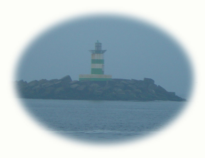
watch. It's an unbelievably straight 96 mile leg from the IJmuiden fairway buoy
to the South Corton South Cardinal Mark at the entrance to the Holm Channel of
Great Yarmouth, probably one of the most straightforward passages we have ever
done.
Weather
forecasts remained consistent for today, with winds of force 3-4 predicted, reducing
2-3 during the day, making good conditions for our long sea passage. From Seaport
Marina its a very easy route out to sea, and we were clear of the harbour wall
almost too quick for me to get the fenders stowed. As we passed the pierheads
we had moderate visibility of about 1 mile, and switched our VHF to foghorn as
a precaution. Six miles off the entrance, a tanker loomed up out of the fog dead
ahead and we were pleased to have our trusty old radar to help us keep a good
watch. It's an unbelievably straight 96 mile leg from the IJmuiden fairway buoy
to the South Corton South Cardinal Mark at the entrance to the Holm Channel of
Great Yarmouth, probably one of the most straightforward passages we have ever
done.
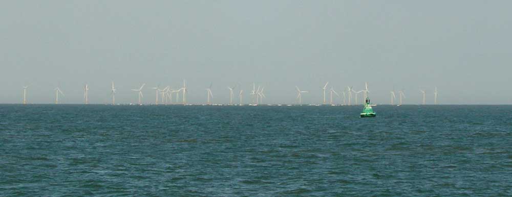 20
miles offshore the visibility closed in to less than a quarter of a mile and we
had to reduce speed to 10 knots to give us time to react to any vessels which
might cross our path. Worse still we had to stop watching Monty Python's Life
of Brian which we had been enjoying immensely. With one of our plotter windows
set to 1:1 million we could see both coastlines and our only consolation was to
watch our onscreen boat crawl gradually closer to home. Fortunately the fog didn't
last long and the captain soon switched off the seat belt signs and restarted
the in-flight entertainment.
20
miles offshore the visibility closed in to less than a quarter of a mile and we
had to reduce speed to 10 knots to give us time to react to any vessels which
might cross our path. Worse still we had to stop watching Monty Python's Life
of Brian which we had been enjoying immensely. With one of our plotter windows
set to 1:1 million we could see both coastlines and our only consolation was to
watch our onscreen boat crawl gradually closer to home. Fortunately the fog didn't
last long and the captain soon switched off the seat belt signs and restarted
the in-flight entertainment.
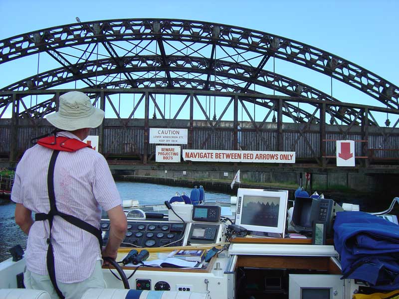 Our
passage was timed to arrive at Great Yarmouth at low water, so that we would have
the option of cruising under the low bridges and continuing on to Horning. Our
enforced speed reduction put this timing in jeopardy and once the visibility was
clear we had to push on in order to get there in time. Being neap tides, we would
only have a short window to get under the bridge, and with only half full fuel
and water tanks we would be slightly higher in the water than we might otherwise
be. We spent the remainder of the passage trying to remember how to calculate
tidal heights and working out the clearance under the bridge at various states
of the tide. We didn't have much spare time and so we had to use the two miles
of river between the Gorleston entrance and the Haven bridge to dismantle our
canopy and radar arch whilst going along. Of course nature does not always do
as is predicted and when we arrived at the appointed hour the tide was still ebbing.
At the second attempt, and with just two inches to spare we squeezed under the
bridge, although we had to forego our height gauge as we could not afford the
safety margin that we had designed into it.
Our
passage was timed to arrive at Great Yarmouth at low water, so that we would have
the option of cruising under the low bridges and continuing on to Horning. Our
enforced speed reduction put this timing in jeopardy and once the visibility was
clear we had to push on in order to get there in time. Being neap tides, we would
only have a short window to get under the bridge, and with only half full fuel
and water tanks we would be slightly higher in the water than we might otherwise
be. We spent the remainder of the passage trying to remember how to calculate
tidal heights and working out the clearance under the bridge at various states
of the tide. We didn't have much spare time and so we had to use the two miles
of river between the Gorleston entrance and the Haven bridge to dismantle our
canopy and radar arch whilst going along. Of course nature does not always do
as is predicted and when we arrived at the appointed hour the tide was still ebbing.
At the second attempt, and with just two inches to spare we squeezed under the
bridge, although we had to forego our height gauge as we could not afford the
safety margin that we had designed into it.
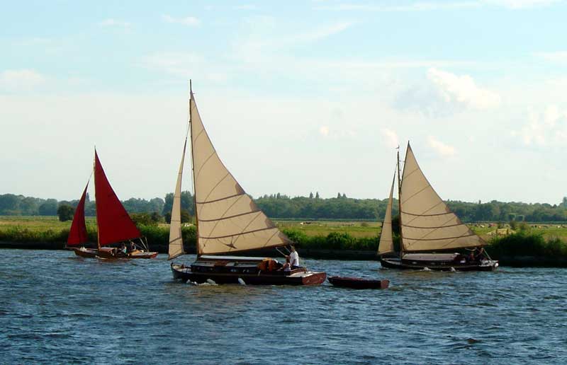 The
weather remained bright and sunny for our cruise upriver to Horning and
it was nice to see all the familiar riverside sights that make Norfolk
feel like home. There was even a trio of sailing yachts in full flight
on the river, led by our old sailing boat, Cirrus (with the red sails).
The
weather remained bright and sunny for our cruise upriver to Horning and
it was nice to see all the familiar riverside sights that make Norfolk
feel like home. There was even a trio of sailing yachts in full flight
on the river, led by our old sailing boat, Cirrus (with the red sails).
Cruising Statistics
Distance: 123 nm
Total to date: 1570 nm
Avg Speed: 11 knots
Duration: 11:00 hours
Diesel: 664 litres
Wind: SW 2-3
Bridges
Vauxhall footbridge (3.2m)
Vauxhall road (3.3m)
Charts
1801.9
AC2322
AC1504
AC1543
AC1536