Oost Vlieland to West Terschelling
Tuesday 20th July
 It's
a short hop across the zeegat between Oost Vlieland and West Terschelling, easily
timed to arrive at high water. There was quiet a muddle of boats leaving the busy
harbour and it was all we could do to find a way out between the moored yachts
and their trailing dinghies. The westerly approach to Terschelling is only passable
near high water with 0.1m at lowest tide and 8 feet when we passed through. The
buoys had recently been moved and although our new 1800 series charts had been
corrected, the CMAP plotter charts were clearly out of date.
 We
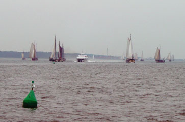
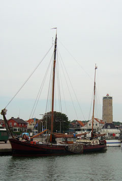
followed the long harbour mole past the ferry terminal and the "brown fleet"
who had arrived in numbers from Vlieland and Harlingen. The modestly sized yacht
harbour is arranged according to size but there was no harbour master on duty
when we arrived. We found a space outside two other boats and even managed to
find a spare electricity cable at the far end of the pontoon.
A short walk from the marina, the town of West Terschelling is the centre of island activities and we enjoyed lunch at Zeezicht, watching the comings and goings of the many visitors. Beyond the town the island drifts to an end in a nature reserve of sand and dunes known as the "Noordvaarder" where boats anchor or dry out. The gently shelving beach provides an ideal playground for kite surfers and beach buggies, as well as the mud-walkers who typify this region.
 To
the east the island is dotted with small villages, easily accessed by well-signposted
cycle paths. We stopped at Midsland, where a tourist market was in progress on
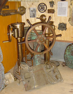
the main street, and then continued on to Formerum to visit the Wreck
Museum. The work of the island's diving club, the museum houses an impressive
collective of finds and trophies from warships, submarines, passenger and fishing
boats lost around the islands over the last century.
Cruising Statistics
Distance: 7 nm
Total to date: 1167 nm
Avg Speed: 6 knots
Duration: 1:15 hours
Diesel: 22 litres
Wind: E2-3
Mooring:
€25
Electricity: €0,50/kWh
Charts
1811.5(D)
1811.5(E)