Oudeschild to Oost Vlieland
Sunday 18th July
 We
continued our island odyssey today by heading for our first "real" Frisian
Island of Vlieland (Texel is officially part of the Noord-Holland region). A tortuous
buoyed channel is marked across the Waddenzee from Oudeschild to Oost Vlieland,
threading its way between sandbanks and impassable at low water. We chose the
safe option, making our way south and then west around the outside of Texel and
through the Molengat channel between Noorderhaaks and the island. Used by the
Dutch air force for target practice, Noorderhaaks, or "the raging ball"
is a moving sandbank just west of Texel. The tide moves the bank gradually eastwards
before starting a new sandbank in the original spot.
 In
order to arrive at Vlieland at high water we had to contend with an adverse tide
during the passage and even though this was with the north west breeze, it made
for a slightly bumpy ride and awkward steering conditions. Once round the north
side of Vlieland we took the Zuider Stortemelk buoyed channel, passing close to
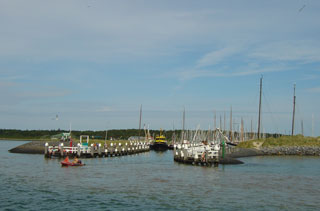
the beach and dunes. The approach to the harbour is well buoyed but the narrow
entrance can be roped off if the harbour is full. We were pleased to see this
wasn't the case today, although the harbour was very busy, with boats rafted six
deep and all the electricity points long since taken.
 Another
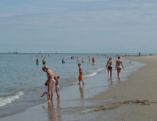
fine afternoon allowed us to enjoy a walk along the beach, lunching at the beach
pavilion 't Badhuys, before returning by way of the only village on the
island. With no cars allowed, the bike is the ubiquitous form of transport, although
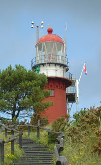
wheelbarrows and tractors are also a popular choice. At the end of the village
street, steps lead up the 40 metre dune atop which stands the island's lighthouse.
From the lookout platform, added in 1929, a fine view of the Waddenzee includes
Texel, Den Helder and Harlingen.
Cruising Statistics
Distance: 37 nm
Total to date: 1160 nm
Avg Speed: 11 knots
Duration: 3:15 hours
Diesel: 200 litres
Mooring:
€25
Electricity: €0,50/kWh
Charts
1811.3
1811.2
1811.9
1811.5(D)
1811.5(B)