Dordrecht to Gouda
Wednesday 23rd June
 There
were gale and storm warnings in force for today, but we opted to go ahead with
our scheduled passage to Gouda, confident that conditions would not affect us
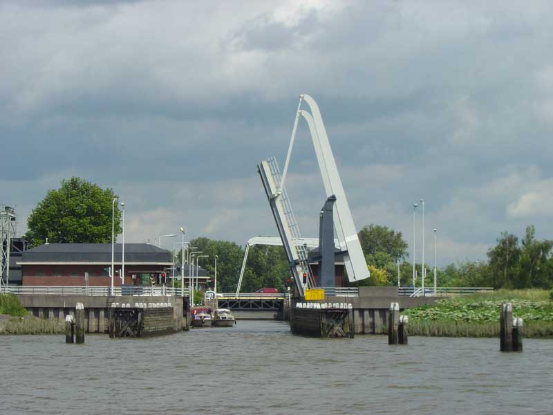
too much inland. Our first obstacles were the two harbour bridges which open independently
of each other and have to be booked separately. Once we had managed to negotiate
these we made our way into the main river and turned north into the R. Noord.
We passed straight under the road bridge at Alblasserdam with its 11m clearance,
but the sailing yacht who had left Dordrecht with us had to wait for the lifting
section to open. We skirted round the outskirts of Rotterdam, foregoing this modern
city with its poor facilities for yachts. Instead we turned north into the narrower
Hollandse IJssel, changing to the ANWB Waterkaart maps from the more detailed
1800 series charts. Even the CMAP electronic charts gave up at this point, with
just a blue line leading to Gouda.
There
were gale and storm warnings in force for today, but we opted to go ahead with
our scheduled passage to Gouda, confident that conditions would not affect us
too much inland. Our first obstacles were the two harbour bridges which open independently
of each other and have to be booked separately. Once we had managed to negotiate
these we made our way into the main river and turned north into the R. Noord.
We passed straight under the road bridge at Alblasserdam with its 11m clearance,
but the sailing yacht who had left Dordrecht with us had to wait for the lifting
section to open. We skirted round the outskirts of Rotterdam, foregoing this modern
city with its poor facilities for yachts. Instead we turned north into the narrower
Hollandse IJssel, changing to the ANWB Waterkaart maps from the more detailed
1800 series charts. Even the CMAP electronic charts gave up at this point, with
just a blue line leading to Gouda.
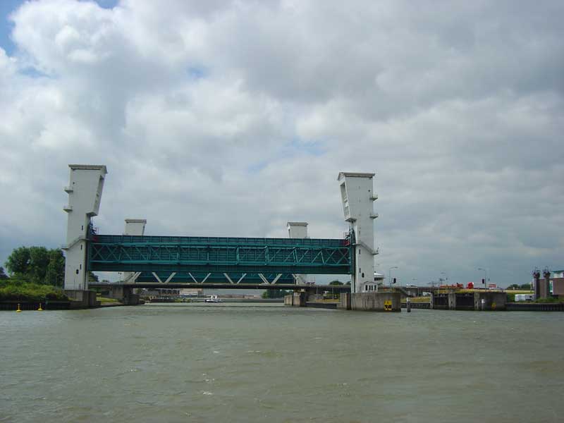
 We
had expected to have to lock through at the Krimpen an de IJssel storm surge barrier
but with the barrier not in use and a clearance under the fixed section of the
Algerabrug of 8m we could pass through unimpeded. South of Gouda we turned left
into the Gouwekanaal and came straight away to the Julianasluis. There, service
was efficient and, contrary to our guidebook, free. Shortly afterwards we turned
right into the Nieuwe Gouwe towards the central canalside moorings of Gouda. A
series of lift bridges and a lock operate on approach and we moored alongside
on the Kattensingel where electricity points are now available. By late afternoon
the forecast strong winds and heavy rain had arrived and we had to take cover
for the rest of the day.
We
had expected to have to lock through at the Krimpen an de IJssel storm surge barrier
but with the barrier not in use and a clearance under the fixed section of the
Algerabrug of 8m we could pass through unimpeded. South of Gouda we turned left
into the Gouwekanaal and came straight away to the Julianasluis. There, service
was efficient and, contrary to our guidebook, free. Shortly afterwards we turned
right into the Nieuwe Gouwe towards the central canalside moorings of Gouda. A
series of lift bridges and a lock operate on approach and we moored alongside
on the Kattensingel where electricity points are now available. By late afternoon
the forecast strong winds and heavy rain had arrived and we had to take cover
for the rest of the day.
 By
morning the weather had improved sufficiently for us to venture out to the weekly
cheese market, held each Thursday morning in the town square. Along with the original
Kaasweg building and its explanatory exhibition, describing the importance
of this eponymous dairy product to the town's fortunes, this forms the main attraction
in Gouda. We took advantage of the free third day's mooring to make the hour's
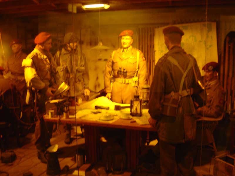
train journey to Arnhem, site of the famously unsuccessful battle of 1944. The
Airborne Museum, housed
in the commanding officer's former headquarters at the Hartenstein Hotel in nearby
Oosterbeek, presents the entire story in film, photos and realistic diorama's.
By
morning the weather had improved sufficiently for us to venture out to the weekly
cheese market, held each Thursday morning in the town square. Along with the original
Kaasweg building and its explanatory exhibition, describing the importance
of this eponymous dairy product to the town's fortunes, this forms the main attraction
in Gouda. We took advantage of the free third day's mooring to make the hour's
train journey to Arnhem, site of the famously unsuccessful battle of 1944. The
Airborne Museum, housed
in the commanding officer's former headquarters at the Hartenstein Hotel in nearby
Oosterbeek, presents the entire story in film, photos and realistic diorama's.
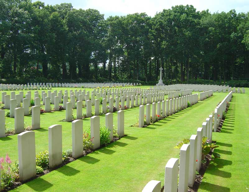 The
nearby Arnhem Oosterbeek Cemetery is the final resting place of some 2000 Commonwealth,
Polish and Dutch forces out of the 10,000 who were deployed in this ambitious
mission.
The
nearby Arnhem Oosterbeek Cemetery is the final resting place of some 2000 Commonwealth,
Polish and Dutch forces out of the 10,000 who were deployed in this ambitious
mission.
Cruising Statistics
Distance: 19 nm
Total to date: 1002 nm
Avg Speed: 5 knots
Duration: 3:45 hours
Wind: SE-SW 4-6
Diesel: 62 litres
Mooring:
€11/3 nights
Electricity: Included
Bridges
Alblasserdam road (11m)
Algerabrug (8m)
Steve Bikobrug (lift)
Rabatbrug (lift)
Pottersbrug (lift)
Locks
Julianasluis
Ir. de Kock van Leeuwen
Charts
1809.8
1809.5
ANWB Waterkaart J
ANWB Waterkaart H