Veere to Great Yarmouth
Saturday 23rd August
 We
knew the cruising season was over when we set off from Veere before it
got light this morning. Strong winds forecast for Sunday and Monday had
prompted us to make a run for home and we had opted to make a passage
straight back to Great Yarmouth from Vlissingen. The North Sea passage
pilot does not cover this unconventional route although it is no longer
than alternatives to Harwich, or from further north in the Netherlands.
We
knew the cruising season was over when we set off from Veere before it
got light this morning. Strong winds forecast for Sunday and Monday had
prompted us to make a run for home and we had opted to make a passage
straight back to Great Yarmouth from Vlissingen. The North Sea passage
pilot does not cover this unconventional route although it is no longer
than alternatives to Harwich, or from further north in the Netherlands.
 After
a straightforward cruise through the Kanal door Walcheren we left the
Westerschelde on the north side of the channel. We turned north west at
Trawl south cardinal marker and followed the bouyed channel past
Westkapelle. From here we could set an almost straight course for Norfolk,
on a bearing of 320° for most of the journey. Our passage took us
through the North Hinder precautionary area, where the main north-south
shipping lanes meet traffic from the Hook of Holland. There didn't seem
to be any particular hazards in doing this and we only saw a handful of
ships on the whole trip.
After
a straightforward cruise through the Kanal door Walcheren we left the
Westerschelde on the north side of the channel. We turned north west at
Trawl south cardinal marker and followed the bouyed channel past
Westkapelle. From here we could set an almost straight course for Norfolk,
on a bearing of 320° for most of the journey. Our passage took us
through the North Hinder precautionary area, where the main north-south
shipping lanes meet traffic from the Hook of Holland. There didn't seem
to be any particular hazards in doing this and we only saw a handful of
ships on the whole trip.
 We
were lacking the main chart for the central part of the channel, having
only a large scale planning chart once we left the coast, but with the
detailed CMAP charts on the plotter we could see there were no obstacles
and could keep track of our progress. 25 miles east of Aldeburgh we made
our first plot on our East Coast chart and knew we were nearly home. Whilst
we had been away the Holm Sand north cardinal buoy had very conveniently
been moved 645 metres south - as published on the Navtex - which allowed
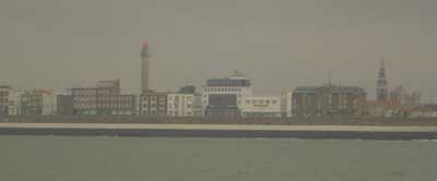
us to head straight for our home waypoint a mile off the Great Yarmouth
harbour entrance.
We
were lacking the main chart for the central part of the channel, having
only a large scale planning chart once we left the coast, but with the
detailed CMAP charts on the plotter we could see there were no obstacles
and could keep track of our progress. 25 miles east of Aldeburgh we made
our first plot on our East Coast chart and knew we were nearly home. Whilst
we had been away the Holm Sand north cardinal buoy had very conveniently
been moved 645 metres south - as published on the Navtex - which allowed
us to head straight for our home waypoint a mile off the Great Yarmouth
harbour entrance.
Cruising Statistics
Distance: 110 nm
Total to date: 2199 nm
Avg Speed: 13 knots
Duration: 8:30 hours
Diesel: 585 litres, 31p/litre
Mooring:
Free
Electricity: N/A
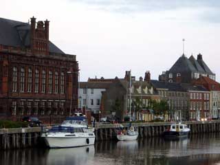
Locks
Veere
Vlissingen
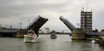
Bridges
Stationsbrug
Schroebrug
Soubrug-draaibrug
Sloebrug
Keersluis
Waypoints
Vlissingen
entrance
51 26.40N 03 36.15E
Vlissingen
HSS NCM
51 25.91N 03 36.19E
Wielingen Noord
51 25.90N 03 28.25E
GVW8 PHM
51 28.60N 03 24.96E
Grauw WCM
51
33.00N 03 15.00E
East Coast Approach
52 10.00N 02 18.00E
Gt.Yarmouth Hbr
52 34.40N 01 45.70E
Charts
1805.2
1803.8
1801.3
1801.5
2449
Imray C70
1543
1536