Zierikzee to Yerseke
Monday 18th August
 There
were no lock or bridge constraints for today's passage and we chose a
later start to give us a last morning in picturesque Zierikzee. A fine
drizzle had started to fall by the time we set off and we were glad of
our sheltered cockpit, as well as the radar and plotter to aid navigation.
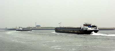
Near Wemeldinge two barges turned in front of us to go into the South
Beveland canal, heading for the Westerschelde and the busy commercial
waters beyond.
 It
was close to low water as we approached Yerseke but the chart showed a
safe water channel at all states of the tide, and we carefully picked
our way through the exposed sandbanks covered in a myriad of posts marking
oyster and mussel beds.
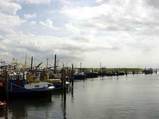
The first harbour to starboard as you approach in the buoyed channel is the new fish dock whilst the old fish dock, second to starboard, is now the Prinses Beatrixhaven where visiting yachts are welcomed alongside smaller fishing vessels and local boats. In contrast to many of the more popular stopping places we enjoyed unlimited free water and electricity, and were told that not many English boats called here.
 The
town itself is heavily dominated by the fishing industry and there is
a handy fresh fish shop next to the yacht harbour with all manner of fish
and seafood, including tanks of live oysters and mussels to buy by the
kilo. There is a small museum in the centre with an English language video,
explaining the history of the town and its oyster beds, but in common
with many of the shops and restaurants this is closed on Mondays. As it
was my parents last night on board we arranged a "gala dinner",
and chose In Den Wijngaard, confirmed by the harbour master as
his favourite in the town. We enjoyed their excellent fish menu with a
full English translation service from the ever helpful staff.
Cruising Statistics
Distance: 13 nm
Total to date: 2064 nm
Avg Speed: 9 knots
Duration: 1:30 hours
Diesel: 60 litres (est)
Mooring:
€16/night
Electricity: Free
Tourist
tax: €0,25pp/night
Waypoints
Ziereksee
entrance
51 37.81N 03 53.46E
Zeelandbrug E
51 37.07N 03 54.73E
Marina
Kats
51 34.30N 03 54.60E
Sas van Goes
51 32.33N 03 56.23E
Yerseke channel
51 30.90N 04 02.57E
Yerseke harbour
51 29.92N 04 03.54E
Charts
1805.8
1805.5
1805.9