St Malo to Lezardrieux
Monday 16th June
 On
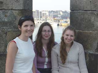
Sunday we were joined by Debbie and Della, who arrived at Dinard airport
and took a taxi the 10km to St Malo's Bassin Vaubin - the Ryanair shuttle
bus apparently having Sundays as their day off. There was time in the
evening for a walk around the old town and ramparts before preparing for
our early start the next day. The weather looked favourable to make the
50 mile passage to Lezardrieux, which would be our most westerly landfall
on this leg of the trip. Locking out of St Malo at high water would mean
we arrived in the Trieux river on a falling tide - not something which
we prefer to do, but there is plenty of water and the outer marina pontoons
are accessible at all states of the tide.
On
Sunday we were joined by Debbie and Della, who arrived at Dinard airport
and took a taxi the 10km to St Malo's Bassin Vaubin - the Ryanair shuttle
bus apparently having Sundays as their day off. There was time in the
evening for a walk around the old town and ramparts before preparing for
our early start the next day. The weather looked favourable to make the
50 mile passage to Lezardrieux, which would be our most westerly landfall
on this leg of the trip. Locking out of St Malo at high water would mean
we arrived in the Trieux river on a falling tide - not something which
we prefer to do, but there is plenty of water and the outer marina pontoons
are accessible at all states of the tide.
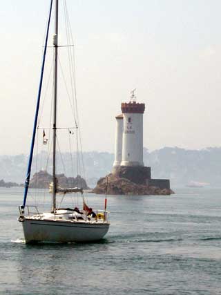
 We
had very light north easterly winds for the passage, which again meant
quite poor visibility. As we approached the Trieux river there was quite
a strong tidal race across the entrance which in these light winds was
just a confused small sea. In stronger winds however, it would be important
to avoid wind against tide in this area.
We
had very light north easterly winds for the passage, which again meant
quite poor visibility. As we approached the Trieux river there was quite
a strong tidal race across the entrance which in these light winds was
just a confused small sea. In stronger winds however, it would be important
to avoid wind against tide in this area.
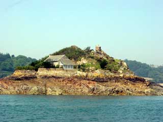
The entrance channel past the Ile de Brehat is littered with rocks which must rise out of the sea bed quite steeply. Although we were in over 100 foot of water there were rocks either side of us only a cable away. We had taken care to check the datum on our charts and set the GPS to match - European for the Admiralty charts and WGS 84 for the plotter - so were confident of our position in this narrow channel.
 We
spotted the visitors berths on the outermost pontoon and chose a likely
looking berth. None of the French marinas seem to mind if you just turn
up and moor - which is much more straightforward than trying to discuss
your requirements over the VHF in french.
We
spotted the visitors berths on the outermost pontoon and chose a likely
looking berth. None of the French marinas seem to mind if you just turn
up and moor - which is much more straightforward than trying to discuss
your requirements over the VHF in french.
Cruising Statistics
Distance: 50 nm
Total to date: 1102 nm
Avg Speed: 13 knots
Duration: 4 hours
Diesel: 250 litres (est)
Wind: Calm
Mooring: €29/night
Electricity:Free
Waypoints
(European
datum)
Bassin
Vaubin Lock
48 38.62N 02 01.50W
Mole des
Noires
48 38.54N 02 01.87W
Le Grand
Jardin
48 40.26N 02 05.10W
Chenal de
la Grand Porte
48 40.22N 02 08.42W
Nord Horaine
NCM
48 55.30N 02 55.30W
La Croix
Lighthouse
48 50.34N 03 03.25W
Olenoyere PHM
48 48.76N 03 05.13W
Pointe de Coatmer
48 48.36N 03 05.43W
Lezardrieux Marina
48 47.44N 03 05.80W
Charts
AC 2700
AC 2669
AC 3673