St Peter Port to St Helier
Wednesday 11th June
 Todays
tides meant that the sill in the Victoria Marina would be accessible from
around 1300 and we planned a final morning in Guernsey before making an
afternoon passage to St Helier. This would time our departure for 2 to
3 hours before high water St Helier, giving us a following tide for the
journey south. There were very light winds forecast but we found that
previously stronger winds from the south west had caused quite a heavy
swell to develop which peaked at around 4 metres. This was a bit disconcerting
at times, as boats could disappear from view between waves.
Daniel had been making himself useful reading the autopilot manual and had worked out the procedure for swinging the compass, something that we had been meaning to do with Brooms but never got an opportunity for. We probably caused a bit of confusion describing a 360° circle outside St Peter Port harbour but it proved to be a useful exercise, with improved accuracy from the autopilot as a result - keeping us dead on track even in the lively swell.
 As
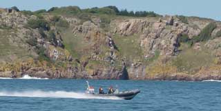
we approached Point Corbiere we were a bit surprised to see a fast RIB
approaching us from our port quarter. They were obviously determined to
speak to us and came right up to the boat and signalled for us to slow
down. It was only when they got close that we could see they were from
Jersey Customs. We were asked several questions about our destination
and departure ports, as well as our home port and nationalities. Fortunately
they did not want to come aboard and check the drinks cabinet, nor did
we have any unauthorised animals on board to complicate the issue. They
could find no fault in our activities, and we were even flying the Jersey
courtesy flag. Having satisfied themselves that we were not a threat to
island security, they zoomed off to their next assignment, leaving us
rather mystified as to their purpose.
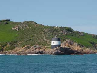
 We
were soon rounding Point Corbiere on the south western tip of Jersey and
making our way along the Western Approach, passing north of passage rock
and within a cable of the shore at Noirmont Point. From here it is just
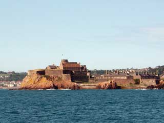
a short hop to St Helier's harbour approach, avoiding the numerous fishing
markers over the shallower areas just to our starboard side, and passing
Elizabeth Castle, the islet fortress in St Aubin's Bay.
 For
our evening's diversion we followed our Channel Island pilot's guidance
to Nelson's Eye, a restaurant overlooking the rocky beach at Havre
des Pas. The food lived up to its recommendation although the service
seemed a bit indifferent.
Cruising Statistics
Distance: 29nm
Total to date: 1014 nm
Avg Speed: 14 knots
Duration: 2 hours
Diesel: 155 litres, 30.6p/l
Wind: V 1-2
Mooring: £18/night
Electricity:£2/night
Waypoints
St Peter Port
49 27.50N 02 31.10W
St Martins
Point
49 25.000N 02 31.00W
Point Corbiere
(2nmW)
49 10.00N 02 18.00W
Banc de
St Brelade
49 09.70N 02 13.00W
St Helier leading light
49 10.00N 02 07.30W
Charts
SC 5604