Weymouth to Dartmouth
Thursday 29th May
 After
fog had lingered all day on Wednesday we were pleased to see clearer skies
today for our cruise to Dartmouth. We had sought advice on the notoriously
tricky Portland Race and had opted for the more easterly route around
the Shambles Bank, rather than the inner passage. We took the 1000 bridge
lift and made our way out of the harbour into the flat calm of Weymouth
Bay. Our passage plan was to carry the tide all the way down to Dartmouth
by cruising at around 10 knots, although this did not seem to improve
fuel consumption over our more usual 15 knots. We had no problems rounding
Portland Bill in very light easterly winds with a clear view of the headland
even from seven miles away.
After
fog had lingered all day on Wednesday we were pleased to see clearer skies
today for our cruise to Dartmouth. We had sought advice on the notoriously
tricky Portland Race and had opted for the more easterly route around
the Shambles Bank, rather than the inner passage. We took the 1000 bridge
lift and made our way out of the harbour into the flat calm of Weymouth
Bay. Our passage plan was to carry the tide all the way down to Dartmouth
by cruising at around 10 knots, although this did not seem to improve
fuel consumption over our more usual 15 knots. We had no problems rounding
Portland Bill in very light easterly winds with a clear view of the headland
even from seven miles away.
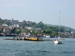
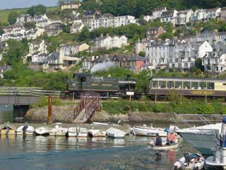 As
we approached Dartmouth we were joined by friends David and Ulla Harvey
in their boat, Gefion, who had cruised from Lymington and we followed
them into the Dart estuary.We took advantage of 28p/litre diesel at the
Dart fuel barge before mooring up at Darthaven marina on the Kingswear
side of the river. The Kingswear to Paignton steam train chugs regularly
past the moorings forming the only link with mainline services.
As
we approached Dartmouth we were joined by friends David and Ulla Harvey
in their boat, Gefion, who had cruised from Lymington and we followed
them into the Dart estuary.We took advantage of 28p/litre diesel at the
Dart fuel barge before mooring up at Darthaven marina on the Kingswear
side of the river. The Kingswear to Paignton steam train chugs regularly
past the moorings forming the only link with mainline services.
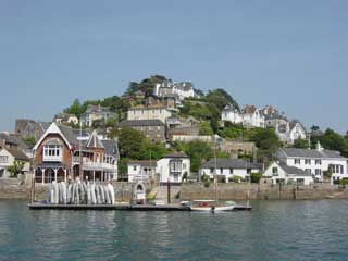 Regular
ferries cross to the Dartmouth side, including the car ferry which is
powered by a loosely attached barge. In the evening we enjoyed the hospitality
of the Royal Dart Yacht Club, who seem to have cornered the best view
on the river as well as a good share of the evening sunshine.
Regular
ferries cross to the Dartmouth side, including the car ferry which is
powered by a loosely attached barge. In the evening we enjoyed the hospitality
of the Royal Dart Yacht Club, who seem to have cornered the best view
on the river as well as a good share of the evening sunshine.
Cruising Statistics
Distance:63 nm
Total to date: 699nm
Avg Speed: 11.5 knots
Duration: 5:30 hours
Diesel: 341 litres (est), 28p/litre
Wind: E 2-3
Mooring: £14/night
Electricity: Free
Waypoints
Weymouth
Harbour entrance
50 36.52N 02 26.710W
Weymouth Harbour leading line
50 36.87N 02 25.770W
Isle of
Portland
50 33.50N 02 19.20W
Bill of
Portland
50 26.80N 02 19.20W
Dartmouth
Approach
50
18.00N 03 30.00W
Castle Ledge
SHM
50 19.50N 03 32.80W
Checkstone
PHM
50 20.63N 03 33.88W
The Bight
50 20.76N 03 34.45W
Charts
SC 5601
SC 5602